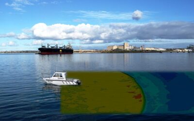
Hydrographic survey services are a very effective way to map the bottom of a river, lake, or other water body. A 3-dimensional model can be developed to show contours, obstacles, scour areas, and large debris using the latest technologies. Even in the most turbid conditions, a hydrographic survey done correctly can be very effective.
Prepare for the survey.
Before beginning, make sure all the equipment is ready to go. Batteries should all be charged, and the boat should be fueled. In addition, with hydrographic survey services, all pre-survey data should be loaded into the computer. This data includes a CAD outline of the water body, track lines for the vessel to follow, and verified quality control points to check into. Also, ensure that you become familiar with any potential obstacles in the area, such as bridges, docks, sand bars, etc.
Run straight lines
Track lines are essential, especially when using a single-beam system; as you navigate the boat, you want to run it along your pre-mapped course by following your track lines as closely as possible. In addition, consistent, parallel lines will lead to the best interpolation results in the post data processing.
Go the distance
When working around seawalls, ensure that data points are gathered as close as possible to the wall. This means you have to run the boat right up to the wall. This can be time-consuming, and cutting corners can be an attractive approach on a long hydrographic survey service, but the close shoreline data is sometimes the most important.
Process data right away
Once you have the data, process it as soon as possible. Waiting for a lengthy period can significantly impact your results, especially when working around a dredging project. Processing the data quickly is also essential if you have to go out and collect more to fill in any holes. Bottom conditions will generally be similar if you gather your data in close time intervals.
While running hydrographic survey services, take your time. It is always better to have too much data than not enough. You never know what you may find.
Here are some best hydrographic survey services in Australia:
- Astute Hydrographic Surveying
- Tailings Dam Survey
- Nobel Surveys
- Autonomous Survey Solutions
- Hydeosurvey Australia
- Total Hydrographic
- Offshore Hydrographic survey services
- Precision Hydrographic Services
- Perth Surveyors
- Norbit High-Resolution Surveys
Hydrographic Survey Services also helps in ship navigation by providing possible paths that a vessel can take. Specific ocean routes may lie at low depths or may have rocks and coral deposits. This poses a significant danger to ships and hence needs to be appropriately recorded. By charting safe routes that do not cross any dangerous terrain, surveying helps the shipping industry. Surveying also has agricultural uses by determining alluvial and silt deposits near water bodies. As deltas have incredibly fertile lands, such areas can be allotted explicitly for farming activities. Also, by studying river discharge, erosion and its effects on arable land can be learned.
Lastly, hydrographic surveys are often conducted by private organizations. They are undertaken for geological reasons, determine appropriate locations for oil and gas structures, install underwater communication devices and military applications. These are usually undertaken by large companies that already own docks and ships. Occasionally, they may even hire other companies to perform their hydrographic survey services for them.


