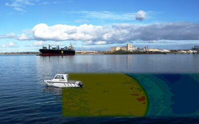
The discussing hydrographic survey is part of the maritime study which involves measurements, analysis, mapping, and description of features that are found underwater. Whereas, bathymetric surveys include the mapping of the underwater topography which is also called bathymetry. The hydrographic survey covers bathymetry, features, and the shape of the shoreline: also the characteristics of current, tides, and waves; and the chemical and physical properties of water also.
Hydrographic surveys services are like the science of calculating and measuring various factors underwater that affect marine activities such as construction, dredging, offshore drilling, etc. There are various reasons why hydrography or hydrographic surveys are important, with the main goal being for navigation.
Determining the depth is used for the location of rocks, navigation, sand bars, and in link with the irrigation and land drainage schemes. Hydrographic surveying is also used to examine the areas that are subjected to scouring and slit and can also be used to measure the flow and quantity of water in connection with various water schemes, flood controls, and power schemes.
When completing a hydrographic survey, there are 5 basic requirements, let’s have a look at them:
Position: Position must be recognized in the area of the survey to locate the survey information. Position can be attained by extending control from past surveys or be established with the help of new positions that are obtained from navigation satellites.
Orientation: A direction must be known to adjust or set up the survey. This can be established by fixing accurately at least two positions in the area of survey or more conventionally by observing the sun to attain the true bearing of the position after the first one.
Scale: The distance between two positions must be examined to allow the survey to signify at a particular scale. This can be done by direct measurement or by calculations if at least two positions are identified.
Shape: After having a position, scale, and azimuth, extra positions will allow the information of the survey to be corrected.
Detail: From the framework that survey can be easily conducted in earnest, collecting all the information which is required.
Talking about the procedure of hydrographic and bathymetric survey, it entails description and measurement of features that affect marine construction, maritime navigation, pipeline damage assessment, dredging, drilling, and related disciplines. Strong emphasis is planted on water depth soundings, shorelines, seafloor, currents, and submerged obstructions that are related to the previously mentioned activities. The surveys also use the rough data which is collected through the hydrography or hydrographic survey process into the crucial information usable by the final user.
Conclusion
When it comes to hydrography or conducting hydrographic surveys, it becomes important to contact the best hydrographic survey services. Various service providers also use small survey vessels to examine the geography of a water body, including the tide measurement, depth, physical features, and shoreline obstacles. Thus, a company that has specialists in conducting hydrographic surveys with extensive knowledge on interpreting, data collection, and mapping can be a great option to go with.


